1970 Map of El Paso, Texas
Mapa de El Paso en 1970 El Paso, Texas
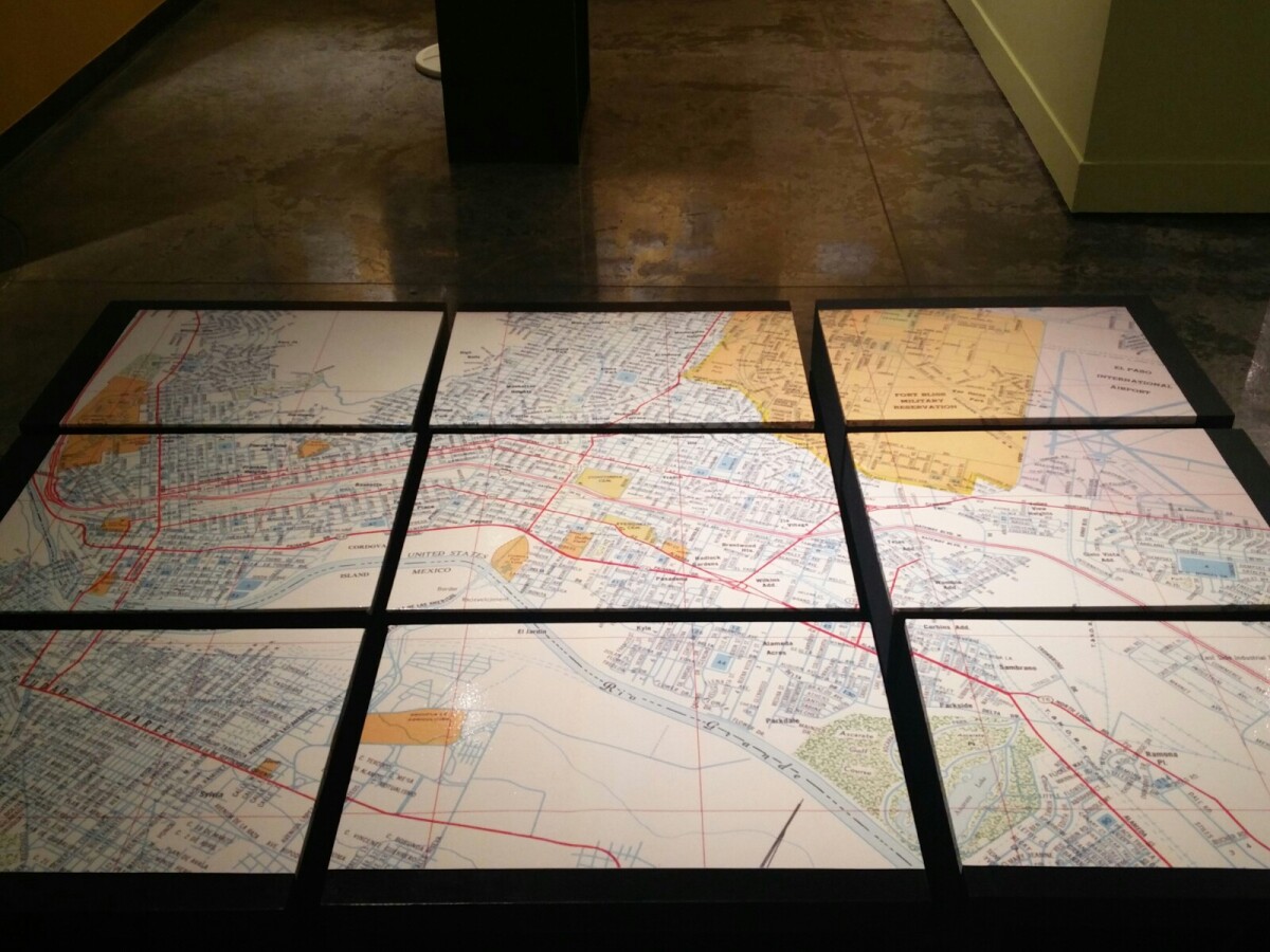
1970 Map of El Paso, Texas
Together these blocks make up a 1970 map of the City of El Paso. The map shows railroad lines and streets. By the 1970's passenger rail service was about to swith to Amtrak.
Report this entry
More from the same community-collection
Photography by Timothy Aquilina
There is nothing more pleasing and rewarding than witnessing the ...
Photography by Timothy Aquilina
There is nothing more pleasing and rewarding than witnessing the ...
Photography by Vallarie Enriquez
There is nothing more pleasing and rewarding than witnessing the ...
Photography by Vallarie Enriquez
There is nothing more pleasing and rewarding than witnessing the ...
Photography by Veronica Marie Heredia
There is nothing more pleasing and rewarding than witnessing the ...
Photography by Veronica Marie Heredia
There is nothing more pleasing and rewarding than witnessing the ...
Photography by Yadira Loya-Carranco
There is nothing more pleasing and rewarding than witnessing the ...
Photography by Yadira Loya-Carranco
There is nothing more pleasing and rewarding than witnessing the ...
Photography by Yolanda Elena Montiel Méndez
There is nothing more pleasing and rewarding than witnessing the ...
Photography by Yolanda Elena Montiel Méndez
There is nothing more pleasing and rewarding than witnessing the ...
Photography by Jaime Alberto Pinal Coello
There is nothing more pleasing and rewarding than witnessing the ...
Photography by Jaime Alberto Pinal Coello
There is nothing more pleasing and rewarding than witnessing the ...
Photography by Jaime Humberto Caldera Chacón
There is nothing more pleasing and rewarding than witnessing the ...
Photography by Jaime Humberto Caldera Chacón
There is nothing more pleasing and rewarding than witnessing the ...
Toddler in Front of Daily Church Service Hours Sign
A toddler standing in front of a sign advertising a Church's ...


