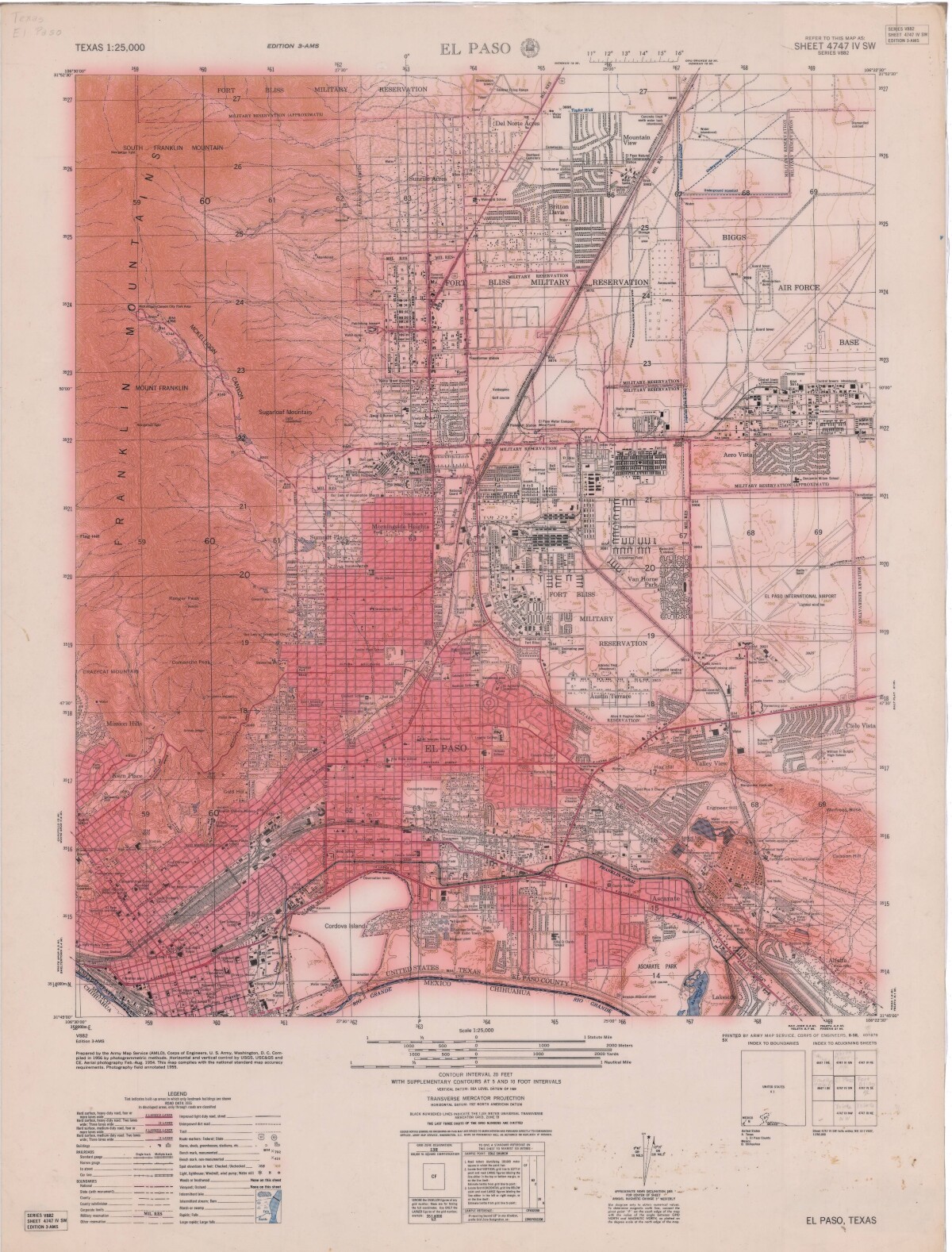
El Paso-Sheet 4747 IV SW
El Paso-Hoja 4747 IV Sur Oeste

El Paso-Sheet 4747 IV SW
This map of El Paso, Texas includes topographical features, but focuses on chief roads, interstates, and highways; the location of Fort Bliss Military Reservation and Cordova Island. The Franklin Mountains and individual mountain names, municipal and utility landmarks, schools, churches and parks are indicated. Border Heritage Center is in Main Library Downtown, El Paso, TX.
Report this entry
More from the same community-collection
Little Theatre under Chapel, Loretto Academy, El Paso, TX, Aug 26, 2022
Photo of woman entering Little Theatre under St. Joseph's ...


