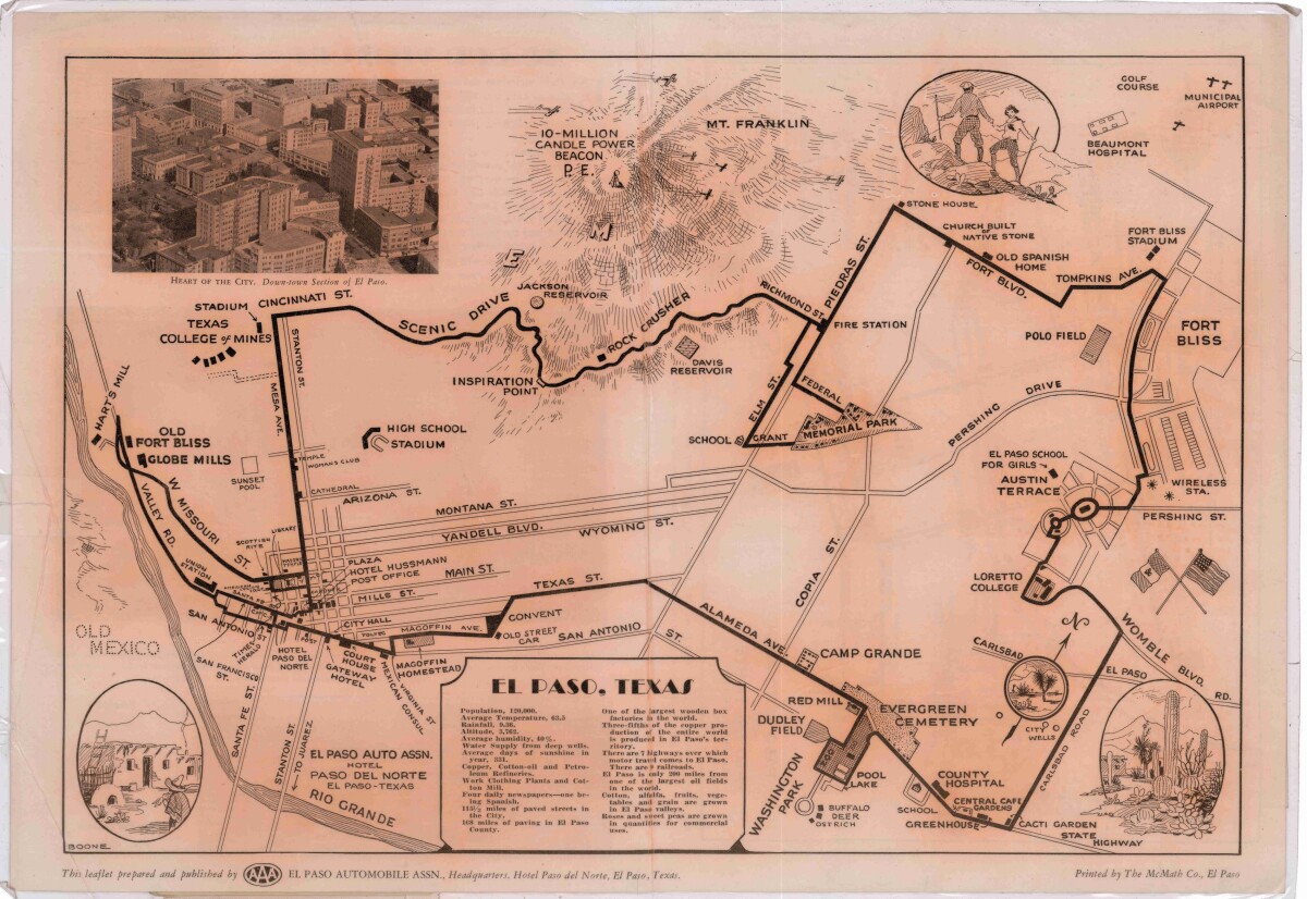
Pictorial Map of El Paso, Texas and Juarez, Mexico
Mapa pictórico de El Paso, Texas y de Juarez, México

Pictorial Map of El Paso, Texas and Juarez, Mexico
Visitor guide with pictorial map of El Paso, Texas and international cross streets into Juarez, Mexico. Location of places of interest in Juarez, Mexico are noted. Reverse side shows main avenues, streets, historical landmarks, train station, parks, military fort, municipal buildings and colleges. Also notes population statistics; infra-structural, weather and agricultural details.
Report this entry
More from the same community-collection
DIGIE Wall Kick-off Celebration
Dionne Mack (El Paso Public Libraries Director) and DIGIE at the ...
DIGIE Wall Kick-off Celebration
Daniel Carey-Whalen (Professor of Museum Studies UTEP) and DIGIE ...
DIGIE Wall kick-off celebration
Mrs. Ingle and baby of Mr. Stephen Ingle, Creative Kids Creative ...
DIGIE Wall Celebration - El Paso, Texas - 2015
From left to right Adair Margo (Tom Lea Institute President), ...
DIGIE Wall kick-off celebration
Adair Margo (Tom Lea Institute President) center with guest and ...
DIGIE Wall kick-off celebration
From left to right, Marilu Valenzuela Aleman( Marketing Director ...
DIGIE Wall Celebration - El Paso, Texas
DIGIE Wall kick-off celebration, 13 February, 2015. Starting on ...


