El Paso (P-4) Sectional Aeronautical Chart
Tabla Aeronáutica Seccional El Paso (P-4)
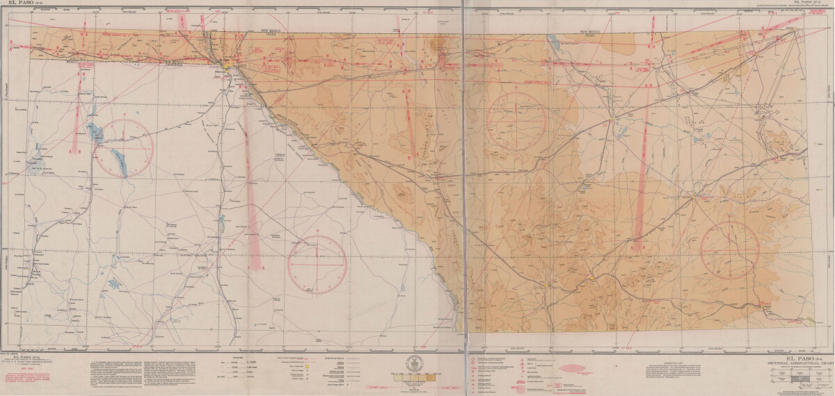
El Paso (P-4) Sectional Aeronautical Chart
Published in April, 1941, this aeronautical map indicates the "shortest and most direct courses between points in question". Population statistics for El Paso, Midland, Sanderson, Texas; and Ciudad Juarez, Mexico are provided. The legend includes symbols for army, navy and marine corps fields; commercial and municipal airports; lighting facilities and airspace reservations.
Report this entry
More from the same community-collection
Folklorico Dance Recital with Castanets
Toni Marie Jones Gymnasio Dublan, Chihuahua, Mexico, June, 1998
First Grade Class Picture Escuela Manuel, Colonia Dublan
First Grade Class Picture, Escuela Manuel, Colonia Dublan, ...
Fourth Grade Class Picture, Escuela Manuel, Colonia Dublan
Fourth Grade Class Picture Escuela Manuel, Colonia Dublan, ...
Kindergarten Class Picture, Escuela Manuel, Colonia Dublan
Kindergarten Class Picture, Kindergarten Classroom, Escuela ...
Third Grade School Picture, Escuela Manuel, Colonia Dublan
Third Grade School Picture, Escuela Manuel, Colonia Dublank, ...
Third Grade Class Picture, Escuela Manuel, Colonia Dublan
Third Grade Class Picture, Escuela Manuel, Colonia Dublan, ...
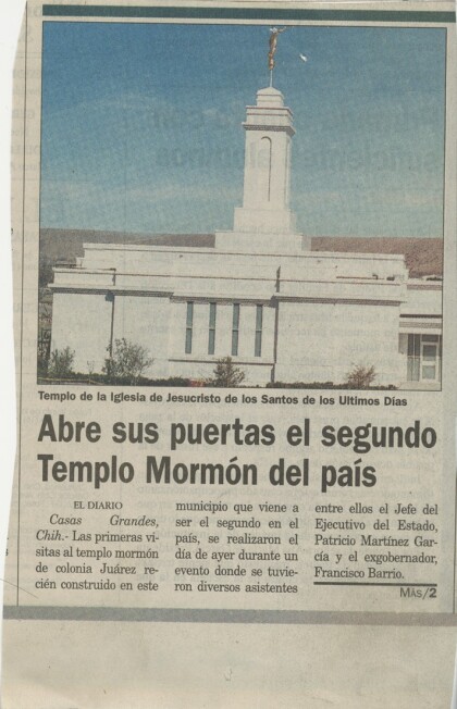
Article about the Colonia Juarez Temple
Article about the Colonia Juarez Temple, Nuevo Casas Grandes, ...
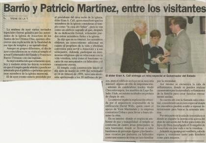
Continuation of Article about the Colonia Juarez Temple
Continuation of Article about the Colonia Juarez Temple, Nuevo ...
JLEP- Provisional Project 2020-2021
The Junior League of El Paso, Inc. (JLEP)’s Provisional Class ...
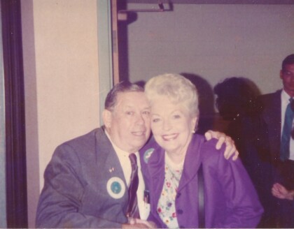
Felix Antone Jr. of El Paso meets Governor Ann Richards, 1989
Felix Antone Jr. of El Paso meets Governor Ann Richards, 1989


