County Map of Texas
Mapa de Condados de Texas
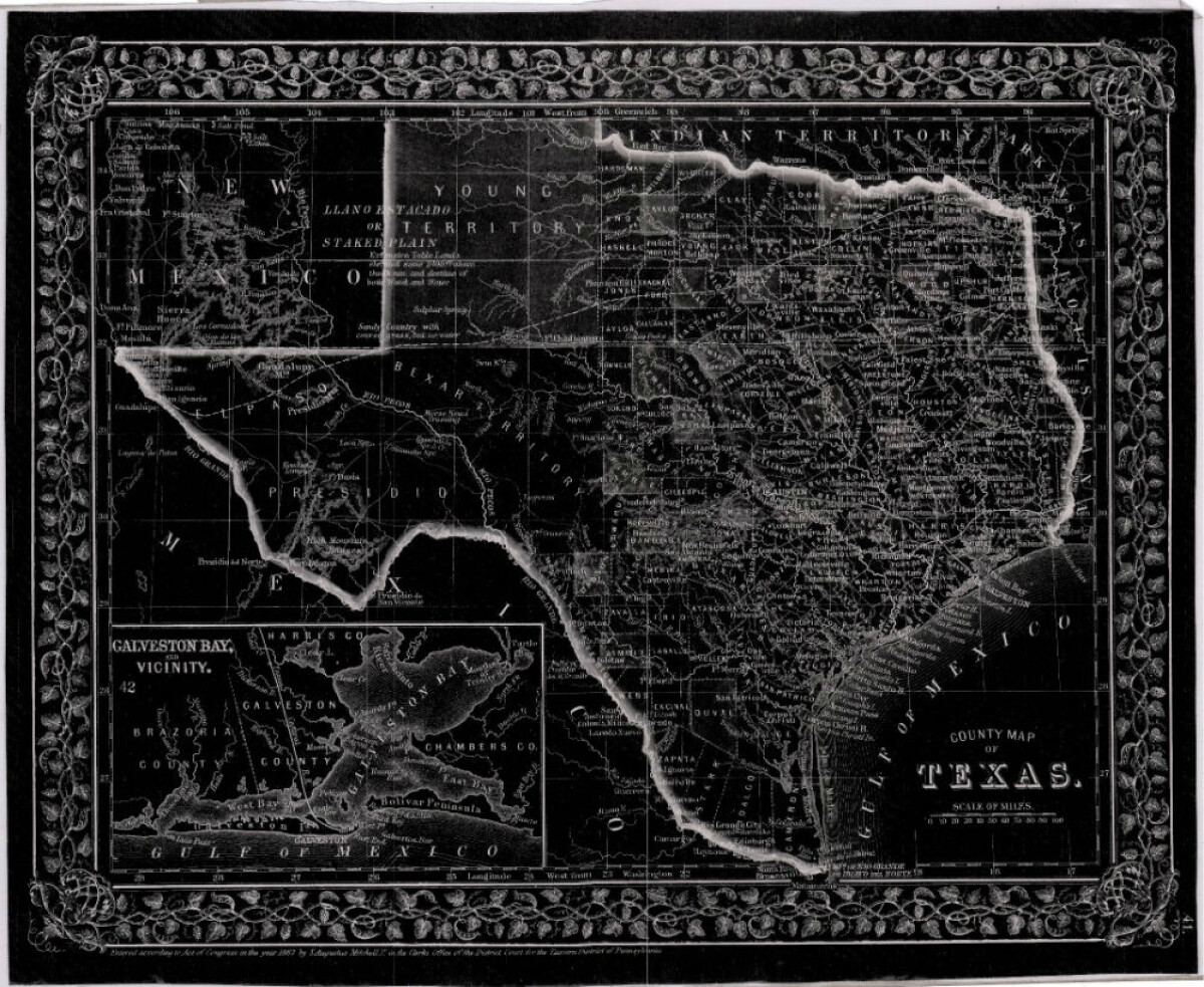
County Map of Texas
This is a county map of Texas represented in black, white and dark gray shades. This map includes an inset of Galveston Bay and the vicinity. Bordering states of New Mexico, Arkansas, and Louisiana and the country of Mexico are indicated. Topographical features-rivers, rios, mountains and bays are shown; and slight shading differences define neighboring counties. Chief cities and towns are indicated.
Report this entry
More from the same community-collection
Cover of the 34th Annual Southwestern Sun Carnival Program
Since 1936, New Years in El Paso has been rung in by the Sun ...
DIGIE - Award for Technology Competition
Jamie Knoedler, Community Engagement Coordinator receives an ...
George Maloof III - Curator of Archaeology Museum
George Maloof III. - Curator of Archaeology Museum - El Paso, ...
Ruben Gonzalez -Honored Veterans Day - 2015
Ruben Gonzalez -Honored Veterans Day - 2015. Streets and ...
Father Nerinckx founder of the Sisters of Loretto
Rev. Charles Nerinckx was a Roman Catholic missionary priest ...
Herminia and Ray Duran's Wedding Toast
Herminia Cardiel Duran and Ray Duran toast alongside area ...
Herminia and Ray Duran's Wedding Toast
Herminia and Ray Duran toast as newlyweds next to Herminia's ...
