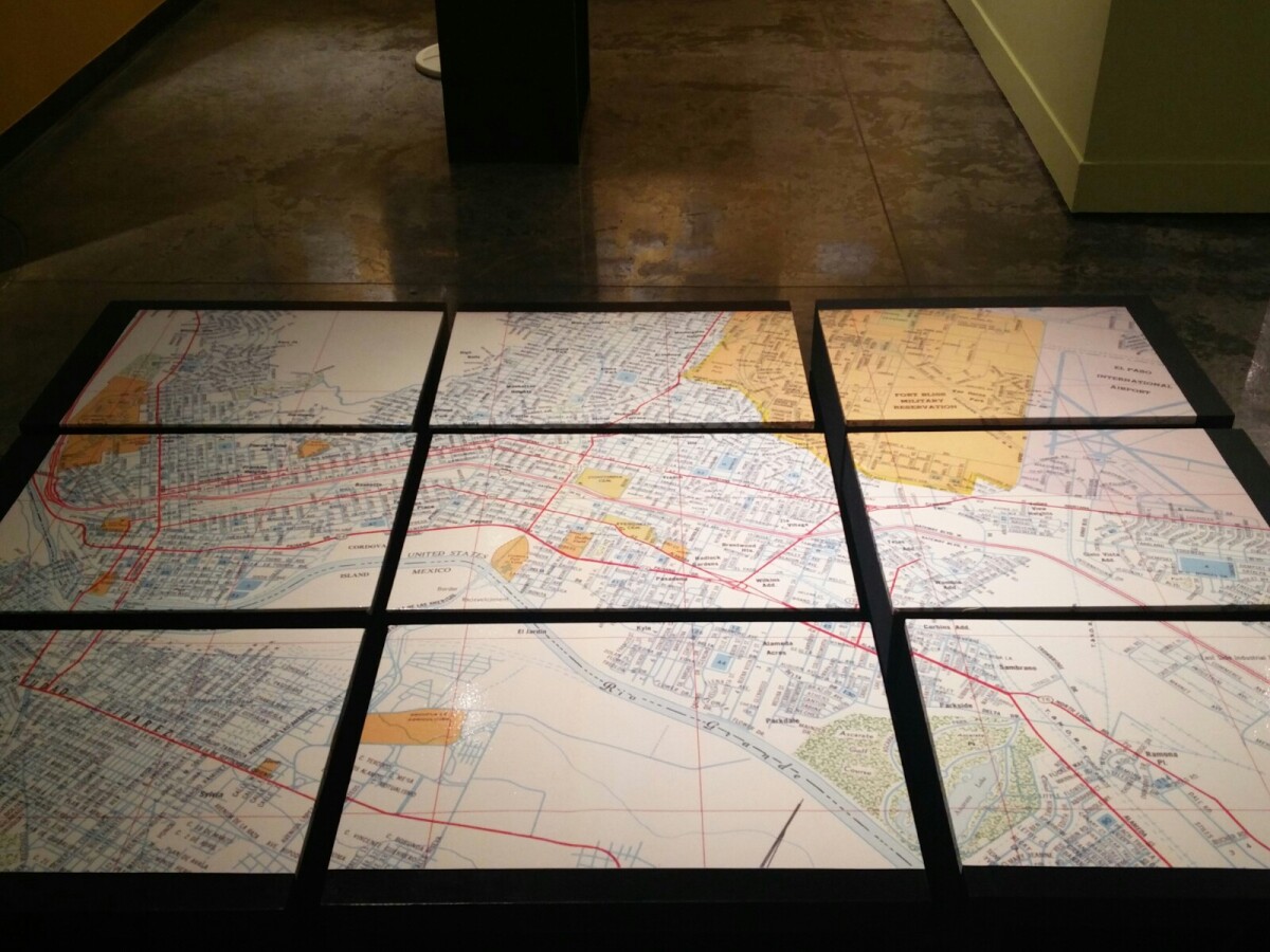
1970 Map of El Paso, Texas
Mapa de El Paso en 1970 El Paso, Texas

1970 Map of El Paso, Texas
Together these blocks make up a 1970 map of the City of El Paso. The map shows railroad lines and streets. By the 1970's passenger rail service was about to swith to Amtrak.
Report this entry
More from the same community-collection
The White House, Mills Building, and The Plaza Hotel
All of these famous El Paso landmarks in the historic Pioneer ...
The White House Department store
This department store has been around for over 100 years in one ...
Inside the White House - El Paso, Texas
One of the oldest and most well-known businesses in El Paso, ...
Me and the White House Department Store
This is a picture of me standing in front of the building that ...
Julia Bussinger - Visionary For The Digital Wall Says Goodbye
Julia Bussinger - Director of the El Paso Museum of History says ...


